8.06.2009

Mount Vesuvius, One of World's Most Dangerous Volcano

Mount Vesuvius is a stratovolcano located in the east of Naples, Italy. It is the only volcano on the European mainland to have erupted within the last hundred years. It is considered as one of world's most dangerous volcano because of the population of 3,000,000 people living nearby.

Mount Vesuvius with it's crater seen from a plane
Mount Vesuvius with it's crater seen from a plane. (Source)


The most famous eruption of Mount Vesuvius happened in AD 79 that led to the destruction of the Roman cities of Pompeii and Herculaneum and the death of 10,000 to 25,000 people.
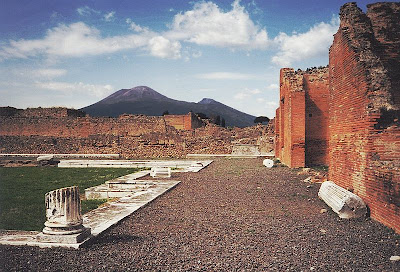
Mount Vesuvius seen from City of Pompeii
Mount Vesuvius seen from City of Pompeii which was destroyed in the eruption of AD 79. (Source)


The summit of Mount Vesuvius is open to visitors and tourists and there is a small network of paths around the mountain that are maintained by the park authorities on weekends. There is also an access by road to within 200 metres (660 ft) of the summit, but thereafter access is on foot only. There is a spiral walkway around the mountain from the road to the crater.
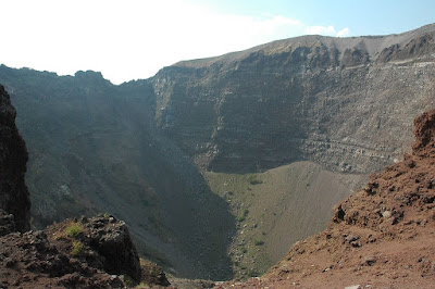
Inside the Mount Vesuvius crater
Inside the Mount Vesuvius crater where tourists can take a pictures. (Source)


The Mount Vesuvius area it is the most densely populated volcanic region in the world. The area around it was officially declared a national park on June 1995.

Mount Vesuvius seen from Italian City of Napoli
Mount Vesuvius seen from Italian City of Napoli. (Source)
8.04.2009

Bay of Fundy, World's Highest and Lowest Tides

Located between the Canadian provinces of New Brunswick and Nova Scotia, Bay of Fundy features the world's highest, at 16.2 meters, and lowest tides.

Everyday 100 billion tons of seawater flows in and out of the Bay of Fundy during one tide cycle. It is estimated that during this cycle, more water flows in and out of the bay than the combined flow of the world’s freshwater rivers. It is this phenomenon that tourists are drawn to this amazing place. Visitors can see two extraordinary high and low tides every 24 hours.

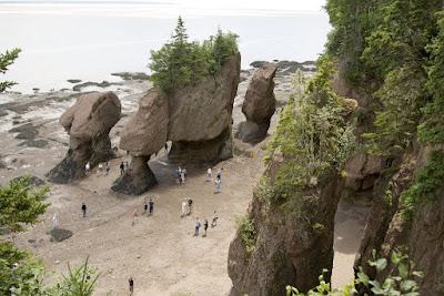
hopewell rocks at low tide
The famous Hopewell Rocks at low tide. (Source)


hopewell rocks at high tide
The famous Hopewell Rocks at high tide. (Source)


The bay's extreme tides create a dynamic marine ecosystem. Aside from extreme tidal effects - vertical, horizontal, rapids and tidal bores, it is also renown for its coastal rock formations and sustainable coastal development. It is also a critical international feeding ground for migratory birds, a vibrant habitat for rare and endangered Right whales, one of the world’s most significant plant and animal fossil discovery regions.

bay of fundy tide levels map
Bay of Fundy's tide level. (Source)


Bay of Fundy is one of North America’s top ten nature tourism destination. Every year, an average of 1 million nature tourists come to this place to experience the tides.

hopewell rocks beginning high tide
Tourists watching the beginning of high tide. (Source)


bay of fundy high and low tide view
High and low tide view. (Source)