9.01.2010

K2 Mountain, World's Second Tallest Mountain

With a peak elevation of 28,251 ft, K2 is the second tallest mountain on Earth, second from Mount Everest. It is part of the Karakoram Range, and is located on the border between the Taxkorgan Tajik Autonomous County of Xinjiang, China, and Gilgit, in Gilgit-Baltistan of Pakistan. It's name is derived from the notation used by the Great Trigonometric Survey. Thomas Montgomerie made the first survey of the Karakoram from Mount Haramukh, some 210 km to the south, and sketched the two most prominent peaks, labelling them K1 and K2.

K2+Peak
K2 Peak. (Source)


Despite it's natural and captivating beauty, K2 is known as the Savage Mountain. This title is due to the difficulty of ascent, severe weather and the 2nd highest fatality rate of climber. In fact, one in every four people who reached the summit died trying to climb it.

It is typically climbed in June, July, or August. The weather near the summit is very unpredictable and dangerous, especially during winter season. So dangerous that K2 has never been climbed in winter.
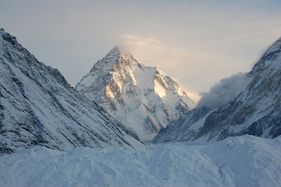
Cloud+in+the+K2+summit
Clouds in K2 Peak. (Source)


Cloud+in+the+K2+summit
Clouds in K2 Peak. (Source)


There are six major routes to have been climbed on the south side of the mountain: West Ridge, West Face, Southwest Pillar, South Face, South-southeast Spur, Abruzzi Spur. The north side is the steepest where is rises 10,499 ft in only 9,843 ft of horizontal distance.

K2's very first successful climb to the summit was done by Italians named Achille Compagnoni and Lino Lacedelli in July 31, 1954.
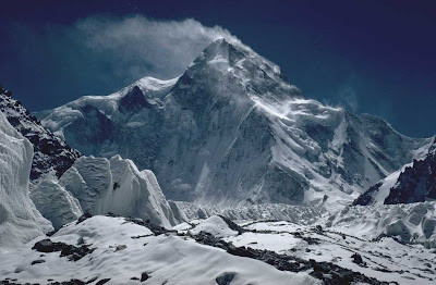
North+Side+of+K2
North side, the steepest side of K2. (Source)


K2 Peak
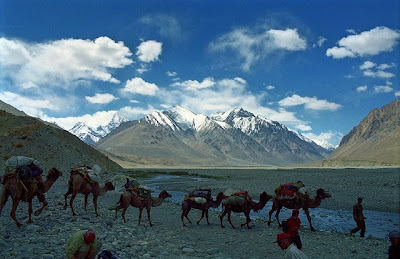
Climbers with K2 in background. (Source)


K2 Peak
On the way to K2 peak. (Source)


K2+Climbers
Climbers with K2 in background. (Source)


In+the+foot+of+K2
Camp in the foot of K2. (Source)


K2+Climbers
K2 Climbers and crew. (Source)
8.30.2010

Salar de Uyuni, World's Largest Salt Flat

Salar de Uyuni also known as Salar de Tunupa is the world's largest salt flat. It measures 10,582 square kilometers and is located in the Potosí and Oruro departments in southwest Bolivia, near the crest of the Andes. It is 11,995 ft above the mean sea level.

Salar+de+Uyuni+as+seen+from+space
As see from space. (Source)

incahuasi+island+in+the+center+of+Salar+de+Uyuni
Incahuasi island in the center of Salar de Uyuni. (Source)


dried+surface+of+the+Salar+de+Uyuni
Dried Surface. (Source)


The Salar was formed as a result of transformations between several prehistoric lakes. The area was part of a giant prehistoric lake called Lake Minchin some 30,000–42,000 years ago. It is covered by a few meters of salt crust, which has an extraordinary flatness with the average altitude variations within one meter over the entire area of the Salar. The crust serves as a source of salt and covers a pool of brine, which is exceptionally rich in lithium. It contains 50% to 70% of the world's lithium reserves and is yet to be extracted.

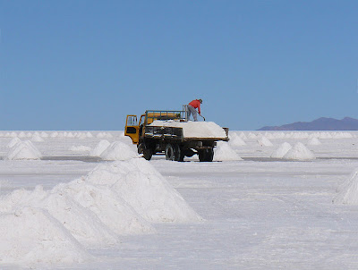
The salt is the Salar is being mined and the salt block is also use to make construction materials like walls for hotels.

salt+production+at+Salar+de+Uyuni
Salt production. (Source)


Salt+building+at+Salar+de+Uyuni
Salt building. (Source)


Salt building. (Source)


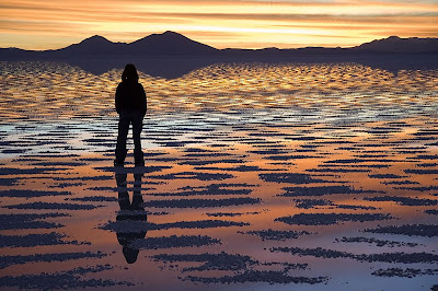
When covered with water, the Salar becomes one of the largest mirrors on Earth.

reflection+at+Salar+de+Uyuni
Reflection. (Source)


watching+sunset+at+Salar+de+Uyuni
Sunset reflection. (Source)


One major tourist attraction is an antique train cemetery which is 3 kilometers outside Uyuni and is connected to it by the old train tracks. The town served in the past as a distribution hub for the trains carrying minerals enroute to Pacific Ocean ports. The rail lines were built by British engineers arriving near the end of the 19th century and formed a sizeable community in Uyuni.

train_cemetery_Salar+de+Uyuni
The train cemetery. (Source)


piles+of+salt+at+Salar+de+Uyuni
Piles of salt. (Source)


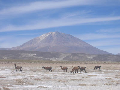
Despite having salt everywhere, has a variety of plants and animals.

llamas+at+Salar+de+Uyuni
Llamas roaming the Salar. (Source)


giant+cactus+at+Salar+de+Uyuni
Giant cactus. (Source)


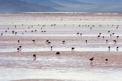
The large area, clear skies and exceptional surface flatness make the Salar an ideal object for calibrating the altimeters of the Earth observation satellites. The Salar also serves as the major transport route across the Bolivian Altiplano and is a major breeding ground for several species of pink flamingos.

Pink Adean flamingos. (Source)


andean+flamingos+at+Salar+de+Uyuni
Pink Adean flamingos. (Source)

8.29.2010

Lake Titicaca, World's Highest Commercially Navigable Lake

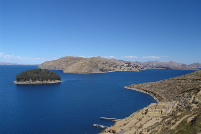
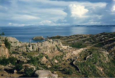
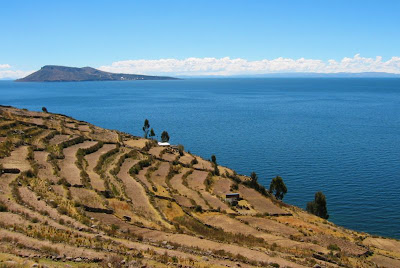
Lake Titicaca is a lake located on the border of Peru and Bolivia. At 12,500 ft above sea level, it is the highest commercially navigable lake in the world. It is also the largest lake in South America.

Lake Titicaca is fed by rainfall and meltwater from glaciers on the sierras that lie adjacent the Altiplano. The five major river systems, Ramis, Coata, Ilave, Huancané, and Suchez and 20 other smaller streams, also fed the lake.

from isla del sol, Lake_Titicaca

Taquile Island Lake Titicaca

Amantani island, lake titicaca

Lake Titicaca

Isla de la luna, Lake Titicaca

Copacabana, Bolivia, Lake Titicaca

A view from space show the lake and glaciers on the sierras that feeds it.

View from space, Lake Titicaca

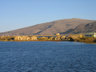
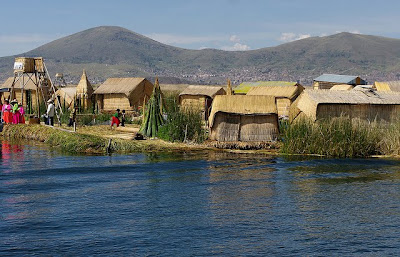
Lake Titicaca has 41 islands, some of which are densely populated. It is notable for a population of people who live on the Uros - a group of 42 or so artificial islands made of floating reeds called totora (a reed that abounds in the shallows of the lake). These islands have become a major tourist attraction for Peru, drawing excursions from the lakeside city of Puno. Their original purpose was defensive, and they could be moved if a threat arose. Many of the islands contain watchtowers largely constructed of reeds.

uros, lake titicaca

floating island, Lake Titicaca

uros, floating reed, Lake Titicaca

boat made of reeds, Lake Titicaca

uros people, floating reed, Lake Titicaca

The Bolivian Naval Force uses the lake to carry out naval exercises, maintaining an active navy despite being a landlocked country.

8.26.2010

Phong Nha - Ke Bang National Park

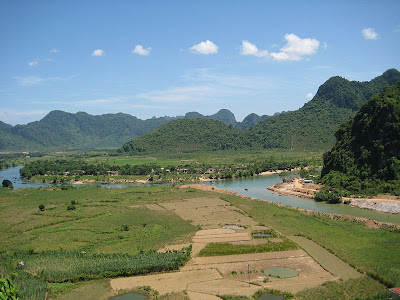
Phong Nha - Ke Bang National Park is a UNESCO World Heritage Site located in the Bố Trạch and Minh Hóa districts of central Quang Binh Province, in north-central Vietnam. The national park zone covers 857.54 km2 and a buffer zone of 1,954 km2. It was created to protect one of the world's two largest karst regions with 300 caves and grottoes and also protects the ecosystem of limestone forest of the Annamite Range region in north central coast of Vietnam.

Rice paddies and lime mountains, Phong Nha-Ke Bang National park
Rice paddies and lime mountains, Phong Nha-Ke Bang National park. (Source)


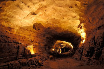
The Phong Nha-Ke Bang area is noted for its cave and grotto systems. It is composed of 300 caves and grottos with a total length of about 70 km, of which only 20 have been surveyed by Vietnamese and British scientists - 17 of these are in located in the Phong Nha area and three in the Ke Bang area. After April 2009, total length of caves and grottoes are 126 km.

Inside Phong Nha Cave, Phong Nha-Ke Bang National park
Inside Phong Nha Cave, Phong Nha-Ke Bang National park. (Source)


Before discovery of Son Doong Cave in April 2009, Phong Nha held several world cave records, as it has the longest underground river, as well as the largest caverns and passageways. Son Doong Cave is the world's largest cave Son Doong Cave, was discovered by a team of British cave explorers of British Caving Association.

The park contains many fascinating rock formations, and Ke Bang forest. The plateau on which the park is situated is probably one of the finest and most distinctive examples of a complex karst landform in Southeast Asia.

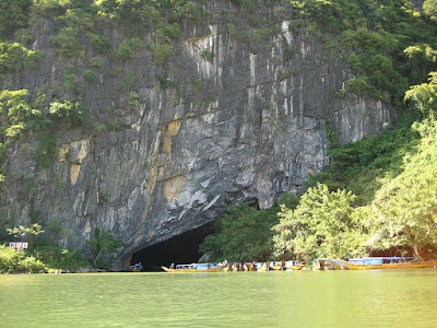
Mouth of underground river, Phong Nha-Ke Bang National park
Mouth of underground river, Phong Nha-Ke Bang National park. (Source)


Inside of underground river, Phong Nha-Ke Bang National park
Inside of underground river, Phong Nha-Ke Bang National park. (Source)


Son river, Phong Nha-Ke Bang National park
Son river, Phong Nha-Ke Bang National park. (Source)


Rice plantation, Phong Nha-Ke Bang National park
Rice plantation, Phong Nha-Ke Bang National park. (Source)


Son River, Phong Nha-Ke Bang National park
Son River, Phong Nha-Ke Bang National park. (Source)


Mouth of underground river, Phong Nha - Ke Bang National park
Mouth of underground river, Phong Nha - Ke Bang National park. (Source)


Mouth of underground river, Phong Nha - Ke Bang National park
Mouth of underground river, Phong Nha - Ke Bang National park. (Source)


Inside Tien son cave, Phong Nha - Ke Bang National park
Inside Tien son cave, Phong Nha - Ke Bang National park. (Source)


Inside Phong Nha cave, Phong Nha - Ke Bang National park
Inside Phong Nha cave, Phong Nha - Ke Bang National park. (Source)


Inside Phong Nha cave, Phong Nha - Ke Bang National park
Inside Phong Nha cave, Phong Nha - Ke Bang National park. (Source)


Boat of tourists, Phong Nha - Ke Bang National park
Boat of tourists, Phong Nha - Ke Bang National park. (Source)


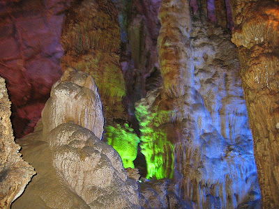
Stalagmite inside Phong Nha cave, Phong Nha - Ke Bang National park
Stalagmite inside Phong Nha cave, Phong Nha - Ke Bang National park. (Source)