Called the eighth wonder of the world, Ngorongoro Crater is the world's largest unbroken and unflooded volcanic
caldera in the Eastern (Great) Rift Valley, northern Tanzania, Africa. It lies 75 miles west of the town of Arusha. The crater measures between 10 and 12 miles across and has an area of 102 square miles. It's rim is heavily forested and rises 2,000 feet above the caldera’s floor to an elevation of 7,500 feet. It is included within a UNESCO World Heritage site designated in 1979.

Panoramic view of the Ngorongoro Crater
(Source)When it was active some 2.5 million years ago, Ngorongoro volcano was one of the world's tallest mountains. After a major eruption, it's volcanic cone collapsed inward leaving the present vast, unbroken caldera as its chief remnant and a flat plain area.

Ngorongoro Crater Map
(Source)The Ngorongoro Crater floor is predominantly open grassland and is haven to a diverse array of animals including elephants, black rhinoceroses, leopards, buffalo, zebras, warthogs, wildebeests, Grant’s and Thomson’s gazelles, and the densest population of lions in the world.

Female lion on a hunt for zebra
Lake Magadi, a shallow soda lake ringed by extinct volcanoes, is renowned as a habitat for great flocks of pink flamingos.

Panoramic view of the Ngorongoro Crater
(Source)The local Masai people also graze their livestock in the crater. Some villagers don't like to be taken pictures, others ask money from tourist in exchange of pictures.
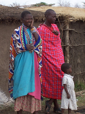
Masai family in Ngorongoro
(Source)When a lodge was built on its rim in the 1930s, large numbers of tourists began visiting the caldera. Since the region’s incorporation into the Ngorongoro Conservation Area in 1959, additional lodges have been built.
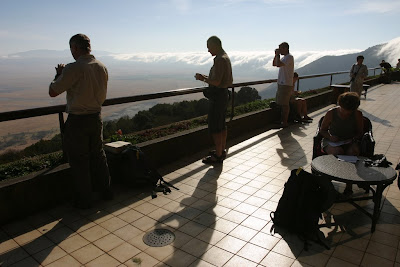
Tourists taking pictures from Ngorongoro Wildlife Lodge
(Source)


